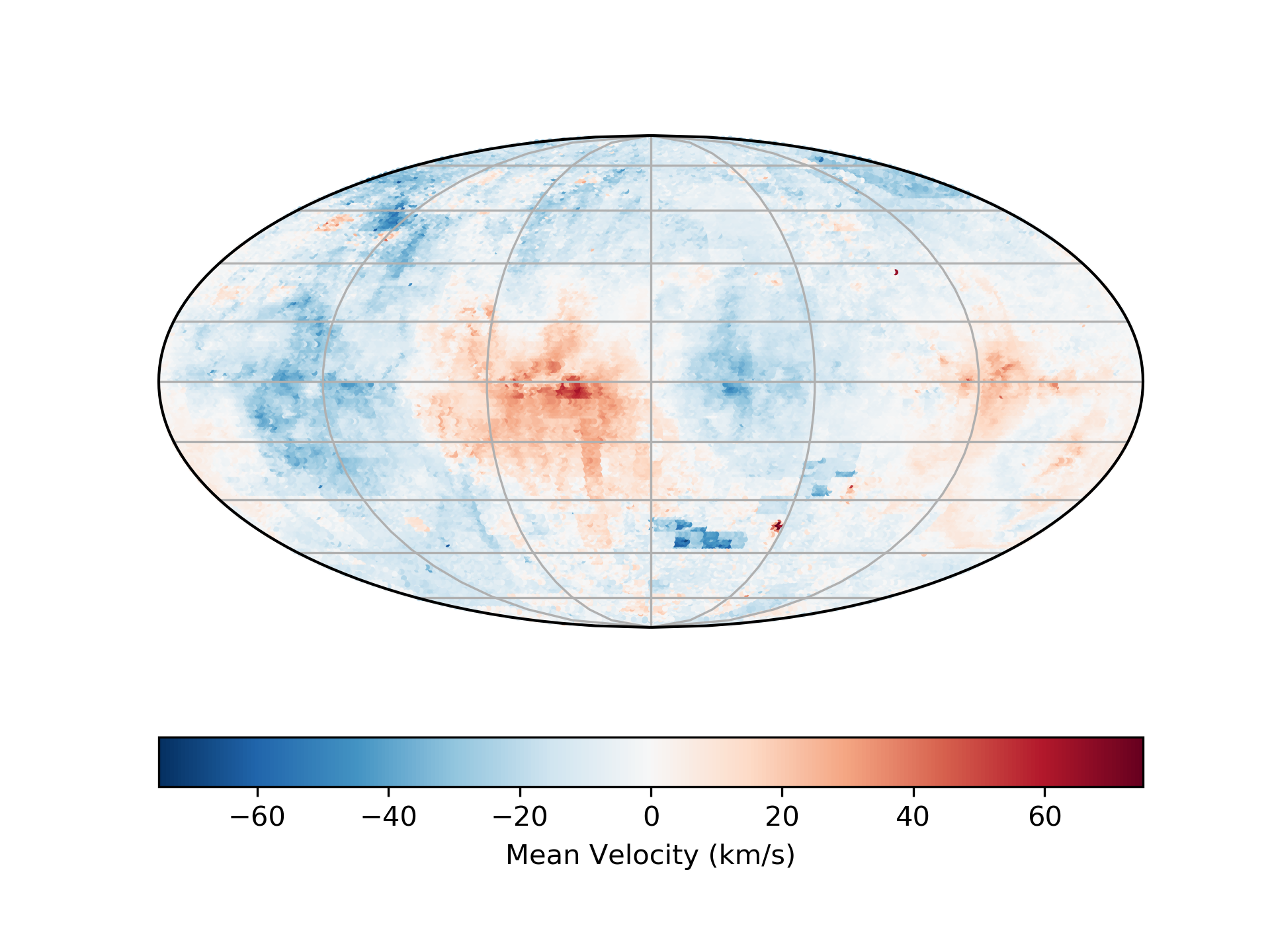
Making Moment Maps with whampy
The SkySurvey class has a method moment to quickly compute
moment maps with the survey:
>>> from whampy.skySurvey import SkySurvey
>>> import matplotlib.pyplot as plt
>>> import cartopy.crs as ccrs

>>> # Load Survey
>>> survey = SkySurvey()

>>> # First Moment
>>> mean_vel = survey.moment(order = 1)
>>> # Sky Map
>>> fig = plt.figure()
>>> ax = fig.add_subplot(111, projection = ccrs.Mollweide(central_longitude=0))

>>> fig = survey.intensity_map(ax = ax, c = mean_vel, vmin = -75, vmax = 75,
...                            norm = None, cmap = "RdBu_r", colorbar = True,
...                            cbar_kwargs={"orientation":"horizontal",
...                                         "label":"Mean Velocity (km/s)"})